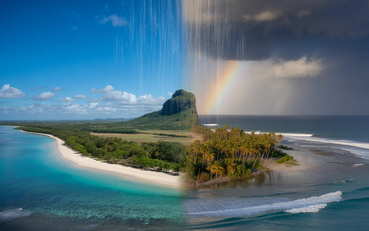
The weather in Mauritius can be summed up in two seasons… but with many nuances.
If you are planning a trip, moving house, or investment project, understanding the Mauritian climate It helps you choose the right time of year, the right region (North, West, East, Central) and to anticipate key events: summer showers, trade winds, heavy swell And cyclones. In this article, you will find a simple and complete reading of the’Mauritius weather, with numerical benchmarks (climate norms) and the right safety reflexes.
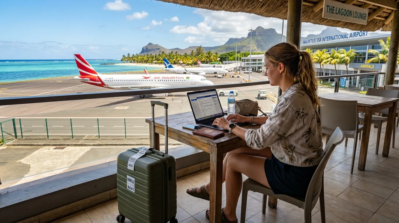
To organize your life project there, you can also consult the website of’Expat Mauritius (expatriation & real estate support) and its expatriation guides.
Understanding the climate of Mauritius at a glance
Mauritius benefits from a tropical maritime climate The sea moderates temperature differences, but the’humidity and the relief create microclimates. Officially, we distinguish:
- Southern summer : of November to April (warmer, more humid, more showers).
- Southern Hemisphere winter : of June to September (cooler, relatively drier, windier).
- Transition month : may And october.
On the island, the weather varies greatly between the coast and the highlands (central plateau), and between the East (often more exposed) and the West (often more sheltered).
Seasons in Mauritius: Southern summer, Southern winter, and shoulder seasons
Southern summer (November to April): heat, humidity, showers
Mauritian summer is the most hot and the most humid. In the long term, the average summer temperature is approximately 24.7 °C (seasonal average), with maximum means which culminate in January–February (approximately 29.2 °C (average of maximum temperatures). Regarding rainfall, approximately 67% annual rainfall occurs during the summer (reference 1971–2000).
Key point: in Mauritius, "wet season" does not mean it rains all day. It often refers to a rhythm sun → shower → clearing, sometimes very localized (one area in the rain, another dry).
Southern winter (June to September): milder, drier, stronger trade winds
In winter, the air is generally less humid and more stable weather. The average winter temperature is around 20.4 °C (seasonal average) and nights can be significantly cooler, especially on the central plateau. The coolest months are generally July and August, with average minimum temperatures potentially dropping to around 16.4 °C (average of minimum values).
Winter also corresponds to a period when the trade winds (East/southeast winds) are more frequent: this is felt especially on the coasts East And South, while the North and the’West are often more sheltered thanks to the terrain.
May and October: the "pivotal" months (often appreciated)
May And october serve as a transition: a good compromise can be found between heat, rain and wind, but with more variable weather (alternating very calm days and more turbulent periods).
Rain in Mauritius: when does it rain the most (and where)?
On an island-wide scale, the average annual rainfall (reference 1971–2000) is indicated around 2010 mm, with months generally wetter in February–March and a hollow around’october.
But this average hides a crucial point: Water doesn't fall everywhere the same way.. The topography (central plateau) favours cloud formations and orographic rainfall, while some coastal areas (particularly in the West) remain drier for much of the year.
Microclimates: North, West, East, South, Central (what this changes on a daily basis)
- West : often drier and more sheltered from the wind (representative stations: Medine). Based on the 1971–2000 averages, the sum of monthly rainfall at Medine is approximately 781 mm/year (calculation based on monthly norms).
- North : generally hot and quite pleasant in winter (resort: Pamplemousses). Sum of monthly averages: approximately 1349 mm/year.
- East : more exposed to the trade winds, often more humid (Station: Fuel). Sum of monthly averages: approximately 1962 mm/year.
- Center (plateau) : cooler and often very wet (station: Vacoas). Sum of monthly averages: approximately 1996 mm/year.
- South : more exposed (wind, disturbed weather), with sometimes more "invigorating" weather (resort: Plaisance). Sum of monthly averages: approximately 1723 mm/year.
Practical tip: if you're looking for the feeling of beautiful weather “beach” In winter, many residents prefer the North and the’West (more sheltered). If you like fresher air and greenery, the Center can be very pleasant, with milder temperatures.
Table – Monthly climate (South, Plaisance resort): temperatures & rainfall (normals 1971–2000)
The table below provides a concrete reference point (Plaisance resort, Southern region): average maximum/minimum temperatures And average monthly rainfall over the reference period 1971–2000.
| Month | Average maximum temperature (°C) | Average minimum temperature (°C) | Average rainfall (mm) |
|---|---|---|---|
| January | 29,8 | 23,0 | 236,6 |
| FEBRUARY | 29,5 | 23,1 | 266,6 |
| March | 29,1 | 22,7 | 203,1 |
| April | 28,2 | 21,8 | 211,5 |
| May | 26,8 | 20,2 | 153,4 |
| June | 25,2 | 18,7 | 95,2 |
| July | 24,2 | 18,1 | 100,2 |
| August | 24,2 | 17,8 | 87,9 |
| September | 25,1 | 18,0 | 59,6 |
| October | 26,4 | 19,2 | 60,1 |
| November | 28,0 | 20,4 | 76,9 |
| December | 29,2 | 21,9 | 171,8 |
Cyclones in Mauritius: timing, actual risks and warning system
Cyclone season: which dates to remember?
The period of highest risk extends from November 1st à May 15 (Official reference point). This does not mean that a cyclone hits the island every year, but that one must be more attentive to weather reports, swell and safety instructions.
Note: even without direct impact, a tropical system can generate heavy swell, heavy rains And gusts in certain regions.
Understanding cyclone alert classes (Class I to IV)
The alert system is built around a threshold of gusts of 120 km/h and a anticipation time. Here's the general idea:
Class I : issued approximately 36 to 48 hours before gusts of 120 km/h.
Class II : to allow (if possible) 12 hours of daylight before these gusts.
Class III : to allow (if possible) 6 hours of daylight before these gusts.
Class IV : when gusts of 120 km/h are observed and are expected to persist.
Essential reflex: follow the official bulletins (and not just screenshots on social media). For information and updates, you can consult the official page of the cyclone warning system and the associated bulletins.
Simple checklist (resident, future expat, entrepreneur) during cyclone season
- Before the season : check shutters/windows, gutters, points of infiltration, and prepare a lamp, a radio, batteries, water, first aid kit.
- When a system approaches : secure outdoor areas (furniture, plants, tools), plan your shopping trips in advance, recharge devices, limit non-essential travel.
- In alert phase : comply with instructions, avoid the sea (even “in calm” conditions in a lagoon), beware of the eye of the cyclone (temporary lull).
- After : remain cautious (electrical wires, branches, flooded roads), check official announcements before fully resuming activities.
Heavy rain & “torrential rain”: official threshold and best practices
In Mauritius, the term torrential rain corresponds to a specific criterion: a warning may be issued when the cumulative total reaches (or risks reaching) 100 mm in a region in one hour, and that the rain is expected to continue.
These episodes can cause flash floods, of the urban floods and sometimes landslides. Even without cyclones, they can occur during the southern summer.
To understand the official framework and bulletins, you can consult the dedicated page. “Torrential rain” warning system (Mauritius Meteorological Services).
Sea temperature, wind and weather feel (what it really feels like)
Water temperature: swimming all year round, but cooler in winter
The sea remains generally pleasant: local guides often describe the water around 27–28 °C in summer and 23–25 °C in winter (with possible occasional drops). For detailed planning (diving, snorkeling, children), consider these values as orders of magnitude which vary depending on the bays, the weather and wind patterns. See a detailed guide (Mauritius.com).
Wind: the trade winds change your “beach weather” depending on the coast
Wind is a key factor in the weather in Mauritius: in winter, the trade winds are often more prevalent (especially in the East and South). In practice, this can make a sunny day feel a bit chilly. If you're looking for calmer seas, the West is often better protected by the coastline.
When to go (or settle) in Mauritius depending on your project
- Beach & relaxation all year round, with often maximum comfort at Northwest in winter (less wind).
- Hiking & outdoor activities : L'’southern winter (June to September) is frequently appreciated for the drier and less heavy air.
- Diving/snorkeling : possible all year round, but visibility and sea conditions can vary depending on swell, wind and rain episodes.
- Installation / relocation Many newcomers appreciate it. may Or october for a weather compromise, while keeping a margin (transition = changing weather).
Recent example (useful for understanding seasonal bulletins)
Weather services also publish seasonal forecasts. For example, the summer 2025/26 outlook (published on November 3, 2025) mentioned an expected summer accumulation of around 1150 mm from November 2025 to April 2026 (approximately 85% of the normal) and an estimated number of named storms between 11 and 13 on the southwest basin of the Indian Ocean (without this implying a direct impact on Mauritius).
Climate change: what the sources say (without extrapolating)
To go further, it is useful to distinguish between:
- The weather (what's happening today/tomorrow: rain, wind, vigilance),
- The climate (trends over decades).
Reference portals aggregate data from climate models (multi-model ensembles, CMIP6) to explore possible changes in temperatures and rainfall at the country level, such as the Climate Change Knowledge Portal (World Bank).
On a global scale, several organizations also monitor changes in sea surface temperatures: for example, Copernicus indicates a global average increase of approximately 0.50 °C since 1982 (global indicator). This does not describe “the sea in Mauritius” in particular, but serves as a reminder of why sea/atmosphere issues are closely monitored in tropical regions. Source: Copernicus Marine.
FAQ – Weather in Mauritius: Frequently Asked Questions
What is the best time to move to Mauritius according to the weather?
For many newcomers, may And october These are practical periods: they are transitional months, often appreciated for their compromise between heat, humidity, and rain. Officially, the austral summer (November to April) is hotter and more humid, while the austral winter (June to September) is cooler and relatively drier. The ideal also depends on your target area: the West is often more sheltered, while the Central region is cooler and wetter.
Does it rain every day in Mauritius during the summer (November to April)?
No. Summer is the wettest period, but rain is often intermittent And located A shower can pass in 20–40 minutes, then give way to sunshine. The weather is highly dependent on the terrain (the central plateau receives more rain) and the coast (the west is often drier). In the long term, most of the rain falls during the summer (reference 1971–2000), but this does not imply continuous rain.
Where to live in Mauritius to avoid the wind and rain?
If your priority is a more sheltered "beach" feel, the“West and often the North These areas are frequently sought after because the terrain can provide protection from the trade winds (especially in winter). Regional climatological data also show significant variations: for example, the 1971–2000 averages combined result in a considerably lower annual total in the West (Medine station) than in the East or Central regions. That said, everything depends on your lifestyle (schools, work, access, budget) and the specific microclimate of your neighborhood.
What does a “Class III” cyclone alert mean in Mauritius?
A Class III is issued to allow, as far as possible, 6 hours of daylight before the arrival of gusts likely to reach 120 km/h. In practical terms, this means the situation is becoming serious: you secure your home, avoid travel, monitor weather reports, and anticipate potential disruptions (transportation, economic activity). The class does not describe the cyclone's "exact strength," but rather an alert level based on risk and timing.
What is the difference between “heavy rain” and “torrential rain” in Mauritius?
“Torrential rain” corresponds to a official threshold : when the observations indicate 100 mm affected (or likely to be affected) in an hour over a region, and the rain is expected to continue. This situation increases the risk of’flash floods (urban areas or areas near waterways) and may trigger specific instructions. Even if the event is short-lived, its impacts can be rapid: it is best to avoid flood-prone areas and follow official bulletins.
And now ?
The weather in Mauritius directly influences your region selection, your installation schedule and your daily habits. If you are preparing for an expatriation (visa/permit, housing, schooling, banking/insurance, real estate or entrepreneurial project), you can start by Expat support Mauritius and browse the expatriation guides to move forward step by step.